Projet
Urbanism
Strasbourg
Place des Halles
mou
Communauté Urbaine de Strasbourg
Dates
2014-2015
Infrastructure
New York (Manhattan)
The Streetcar con the 42nd Street_laureate
mou
The Institute of Rational Urban Mobility, Inc.
Dates
2014
Urbanism
Sophia Antipolis
Sophia Antipolis 2030 Master Plan
mou
Syndicat Mixte Sophia Antipolis
Dates
2011-2014
Urbanism
Marseille
Porte d’Aix
mou
Euroméditerranée
Dates
2011-2018
Urbanism
Montpellier
Ecocity Ode to the Sea
mou
Communauté d'Agglomération de Montpellier
Dates
2010-2012
Urbanism
Grand Paris
Consultation for the future of the metropolis
mou
Ministry of Culture and Communication
Dates
2009
Great Sites
Grenoble
Banks of the Isère
mou
City Grenoble
Dates
2008-2009
Infrastructure
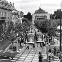
Strasbourg tramway
Urban integration of the tramway
mou
Communauté Urbaine de Strasbourg
Dates
1990-2016
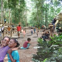
La nature, et particulièrement LA FORÊT est LE Monument du Gabon. Un Monument légendaire véhiculant histoires, craintes, fantasmes, qu’une population majoritairement urbaine porte dans son inconscient et éloigne de plus en plus des réalités et des richesses de son territoire.
Pour redonner ENVIE de parcourir la forêt, de dissiper un certain nombre de fausses vérités, et d’en découvrir toutes ses richesses, notre proposition de sentier pédagogique s’est donné trois objectifs qui constituent le fil rouge du projet :
- Créer un parcours «Grand Spectacle» c’est-à-dire un cheminement qui propose au visiteur une succession de tableaux relançant sans cesse son intérêt.
- Construire un parcours en réutilisant exclusivement des matériaux issus de la région, pour en garantir son authenticité.
- Associer pédagogie et traitement ludique pour accrocher le visiteur, en particulier le jeune publique, sans faire du projet un parc d’attraction.
Le projet du sentier, associé à la promenade dans la canopée, et avec laquelle nous avons cherché toutes les complémentarités possibles, créera un événement capable de générer un nouvel intérêt collectif, meilleur rempart contre les destructions sauvages.
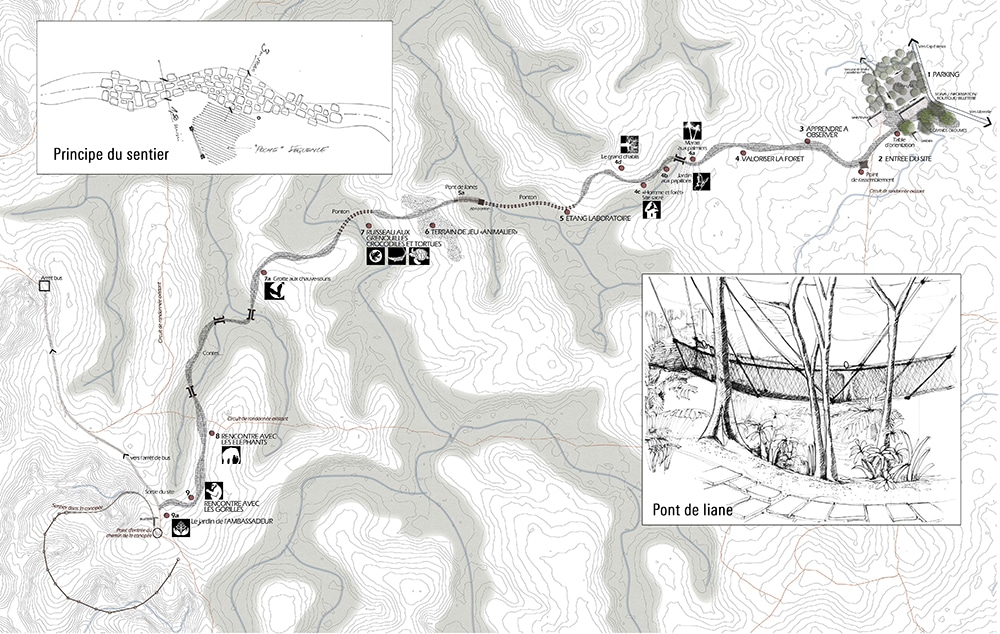
Circuit à travers le parc
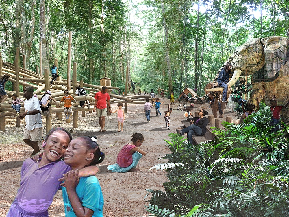
Photomontage autour de l’aire de jeux
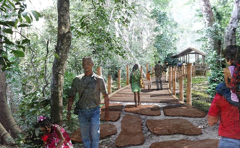
Ponton-belvédère
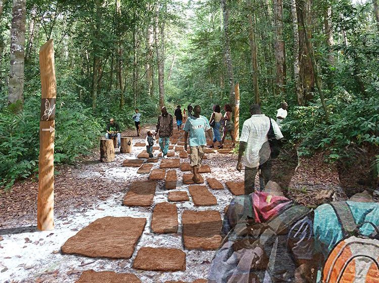
Sentier et éducation ludique
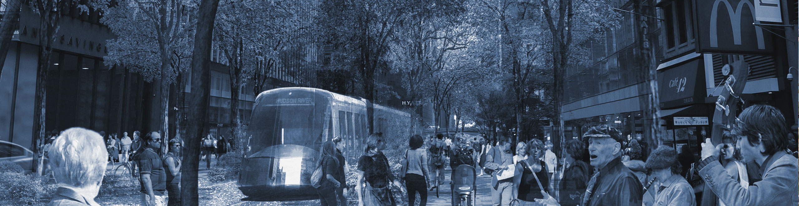
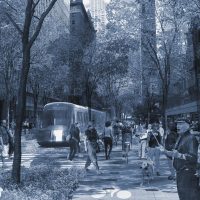
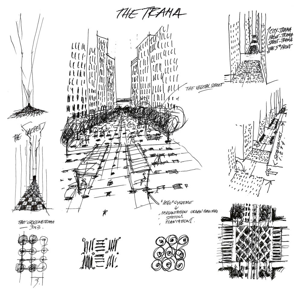
42nd Street is a microcosm of NYC reflecting its multiple facets and the dynamic, diverse and undulating flow of the city. The iconic street traverses multiple environments; a walk from river to river is a journey through NYC’s atmosphere, pace, scenery and culture.
Three urban concepts employed for an auto-free light rail boulevard on 42nd street:
- A Large Linear Garden: Creation of an East-West linear garden lined with trees and an alternating grass and pavement track bed. The linear garden connects the Hudson avec East Rivers, drawing the spirit of the river into the vibrant urban heart of the city.
- The Light Rail Grand Passage: Like a chameleon, the light rail channels the character of each section of its host neighborhood. The design captures and emphasizes the spirit of the surroundings and harnesses the diversity to create a unified continuum that draws the energy from each into a singular “Grand Passage”.
- The Grid: the street layout is designed as a continuation of the concept of the NYC grid plan with its grid streets and grid pattern façades. With this inspiration, the light rail becomes the fifth façade of the city. The street plan incorporates alternating sequences of components, materials, lighting, furniture, fountains, plants, pavement shapes and details which are planned around this horizontal grid pattern.
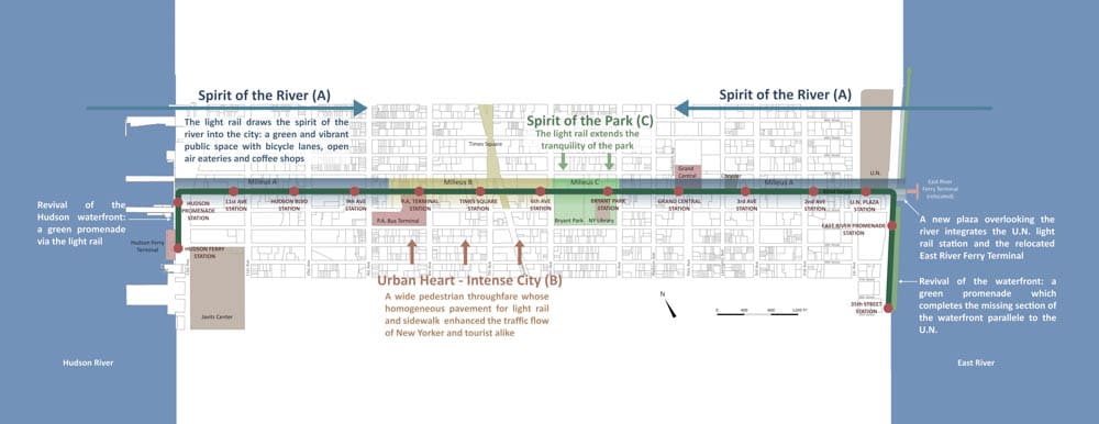
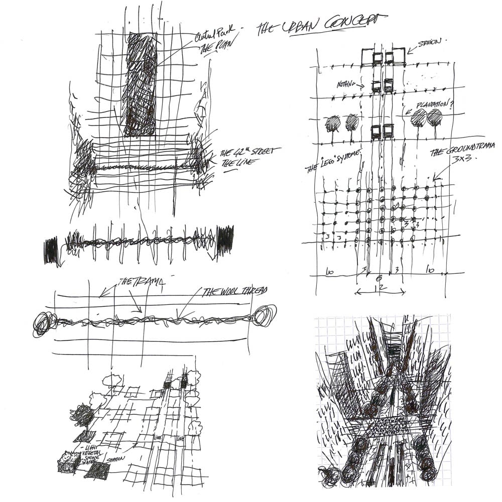
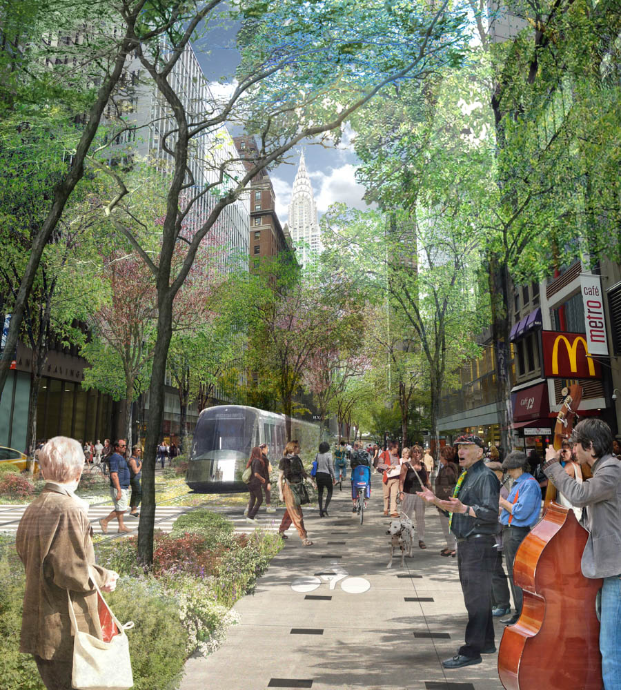
The Design
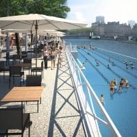
The Spirit of the River (Milieus A) – The East and Hudson River waterfronts are designed as a vibrant green promenade to create a spirit of revival. As it enters 42nd street, the light rail draws that spirit into the city with its eateries, bars and coffee shops lined with open air tables. The bicycle lane, light rail and green pedestrian spaces are illuminated to ensure the vibrancy is alive day and night.
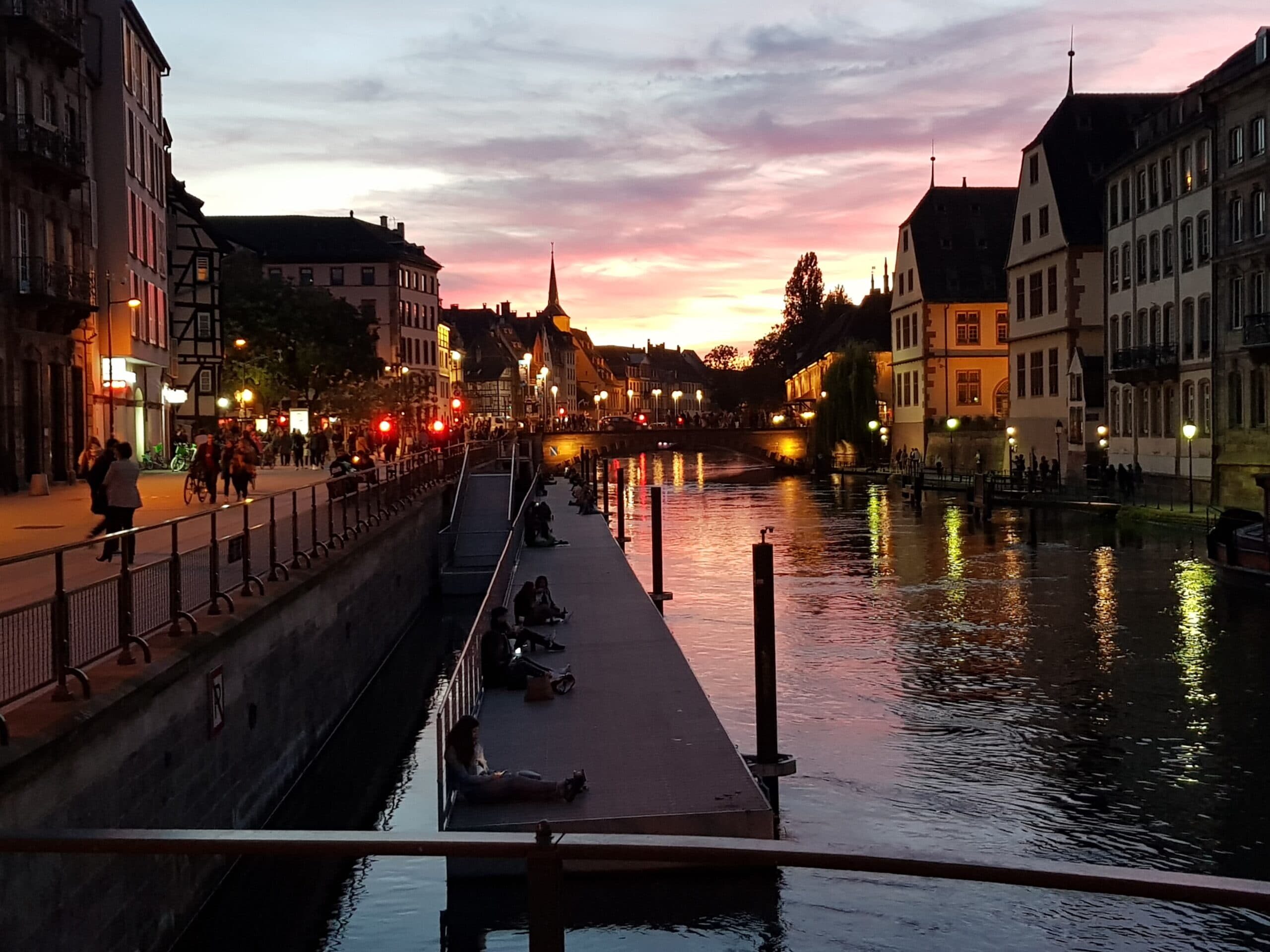
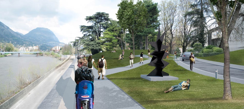
The Isère has a highly suggestive potential. It is not by chance that one postcard in two shows Grenoble in three planes: the mountains in the background, the silhouette of the city in the middle of the picture and the Isère in the foreground. Most of the work consists of redefining a fair balance between the various uses of the river banks moving from a travelling space to a living space.
Expected uses on the banks:
Our proposal does not apply to the banks as a topic in themselves. We have sought to rely on existing or latent practices to boost interconnections. Bridges are favoured places.
The banks are essentially a space for carrying out already existingpractices and linking them together.
To this we add a few fun touches such as swimming. The footbridge, for example, by combining this with the cable car gives a magical touch to the project. Cycling is obviously encouraged with this project, as is walking. The two-way track to the North and cycling facilities in the South connect up existing cycling facilities.
This project is without doubt the most emblematic project of the sustainable city: it affects an essential natural element of the city and recapturing it must be magical and fun.
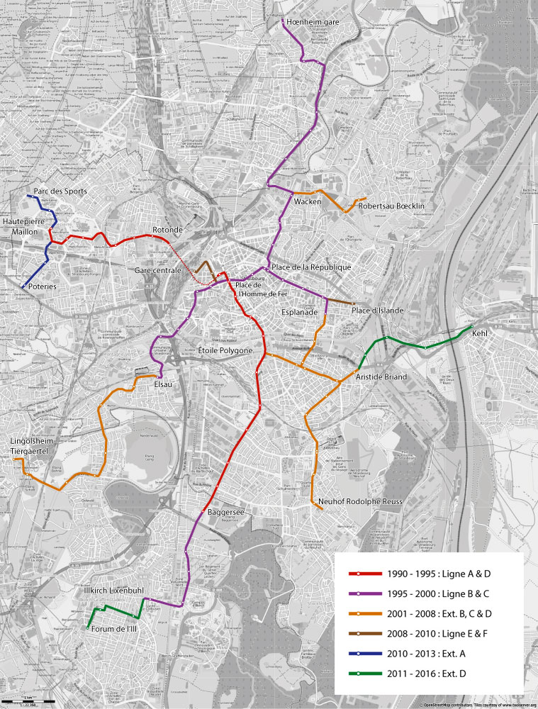
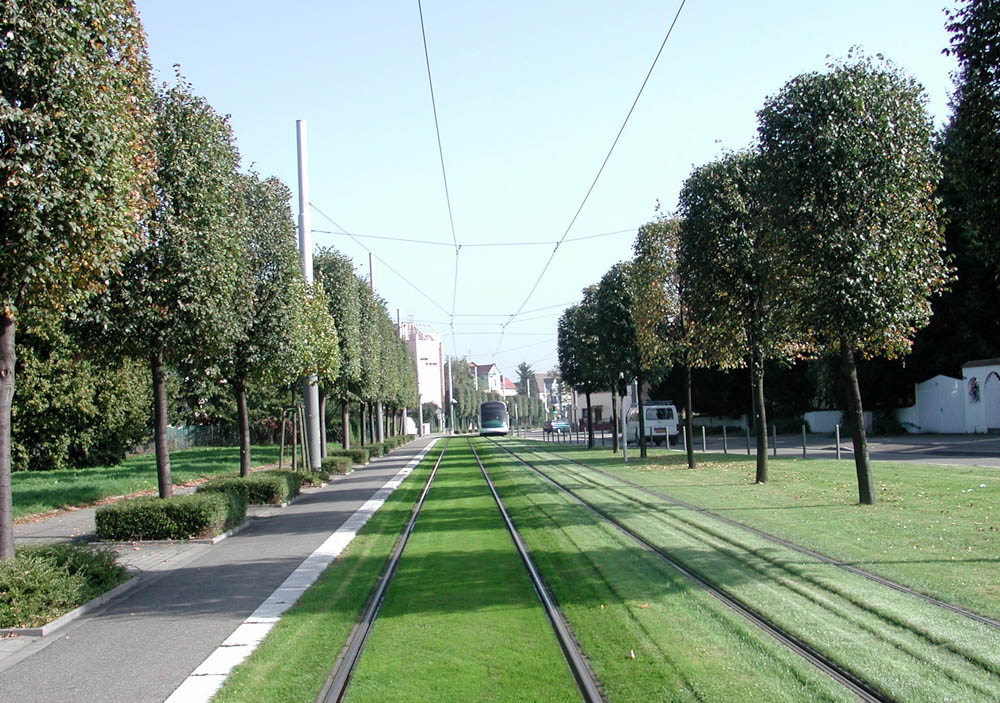
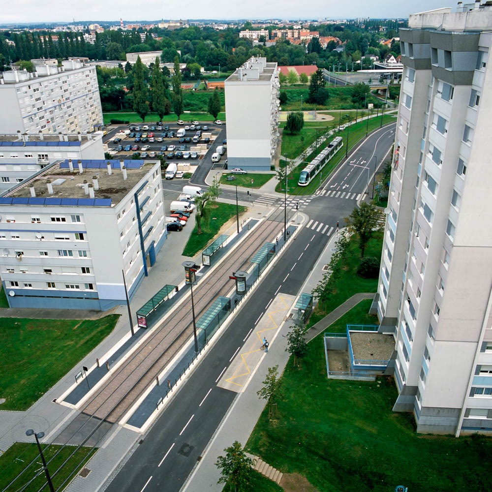
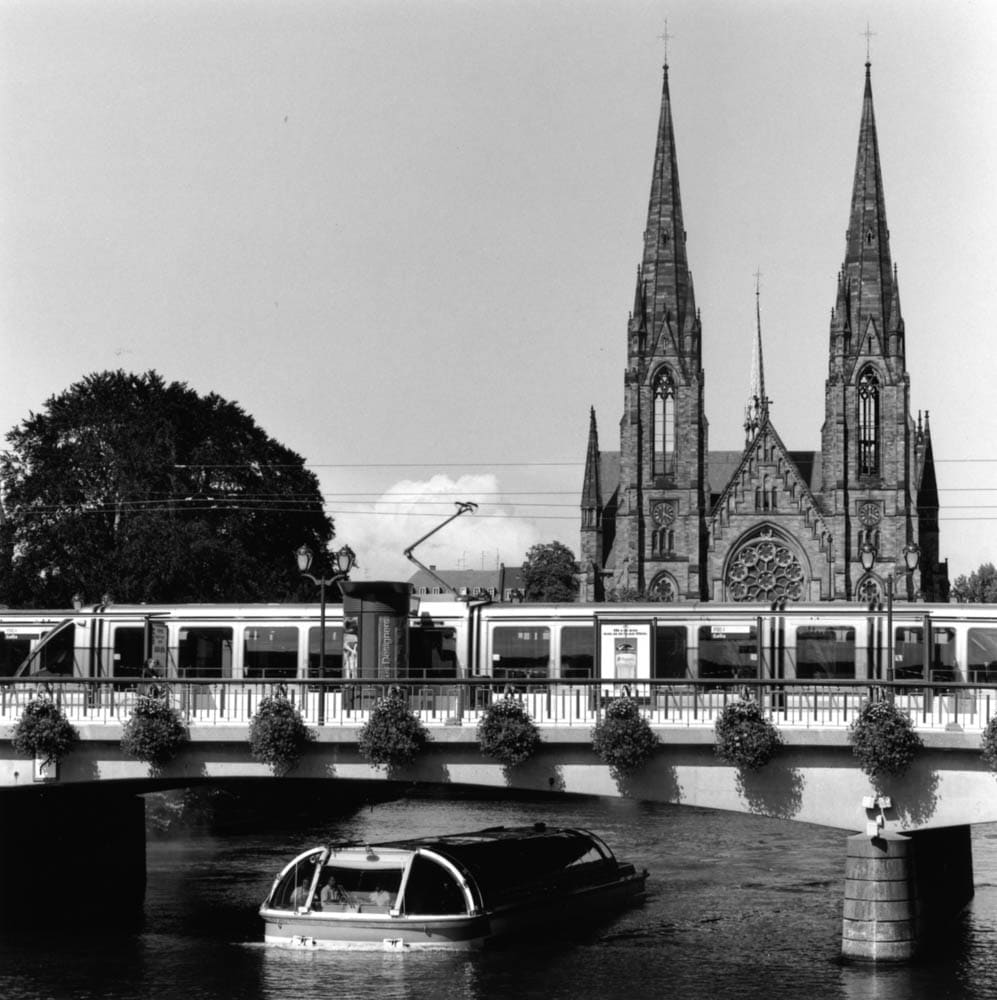
Launched in 1994 by Catherine Trautmann instead of an automatic metro project, this surface public transport project was the starting point for a ‘French school’ of tram systems, marrying together a mobility project with an urban project.
It is a pretty rare phenomenon that the Workshop has participated in this project since its inception and 20 years later are still working on it! In the long term this work has profoundly transformed the city and its suburbs.
With this experience, one can discern three phases in the evolution of urban thinking about infrastructure:
The ‘heroic’ period (1994-2000)
Almost unanimous rejection of the project – considered retrograde, a disaster for traffic, the ruin of shopkeepers, etc. The beginning focused more on the legitimacy of the project than on how to build it; which gave us a lot of freedom.
Five years later, Catherine Trautmann was re-elected triumphantly, which was a strong signal to other hesitant cities…
The ‘Public spaces’ period (2000-2006)
With the construction of the 2nd and 3rd lines, the project took a ‘large scale urban planning’ dimension, characterised by very ambitious treatment of public spaces; the launch of the policy
of sustainable transport and large out-of-town park and rides.
The ‘Urbanistic’ period (2006-2014)
Major projects, restructuring and urban development are totally intertwined with extensions to the network. The ‘2 Rives’ (two banks) project, to create a new city on the banks of the Rhine, is the perfect illustration of this ongoing adventure.
The project moved gradually from a mobility in the city project to a city of mobilities.
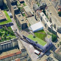
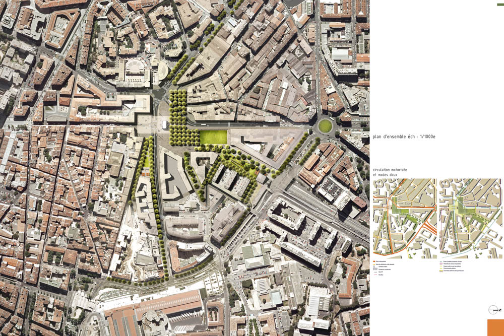
This typical concrete slab architecture from the 1970s is ageing but it enjoys an exceptional and strategic location. The site is a monumental space that turns its back on the city. The purpose of this project is to change it to integrate it better into the district and to serve it better by public transport. The city centre flagship must regain its commercial, tourist and cultural attractiveness through a complex operation involving private and public operators.
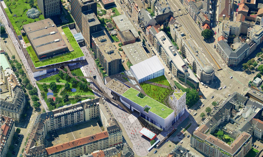
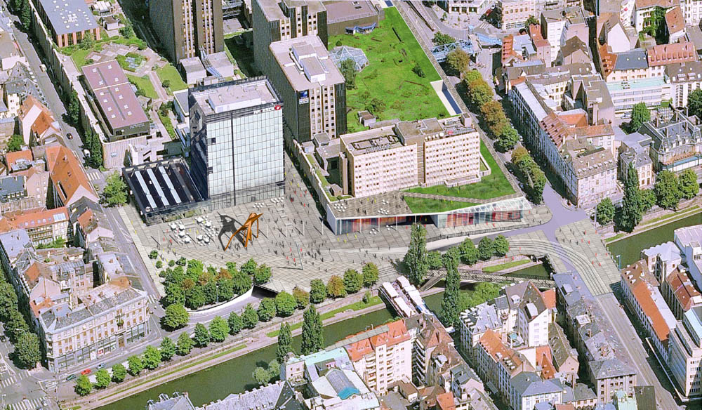

This most complex project requires all urban planning skills: urban form, the infrastructural dimension, a chaotic site.
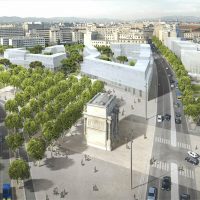
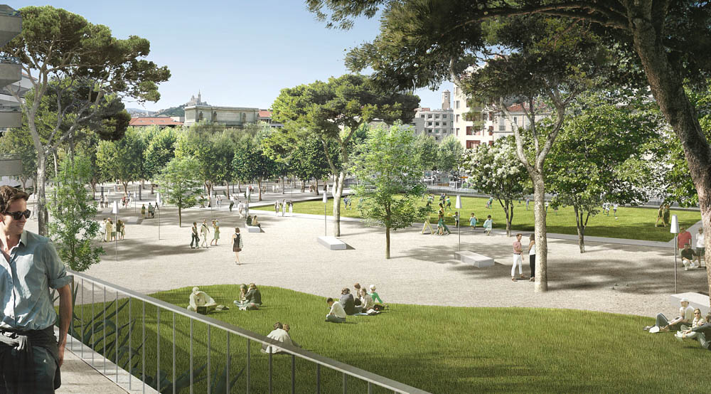
The Porte d’Aix (Aix gate) illustrates the brutal confrontation between bruised fragments of the old town and the vast blocks of the modern city. Modern oxymorons – garden city, green town, individual tower block, etc. – are embodied in a generic oxymoron, the wide gap.
We do not suggest sacrificing anything:
- neither to the structured square;
- nor to a large empty space in its most urban form, i.e. a public park.
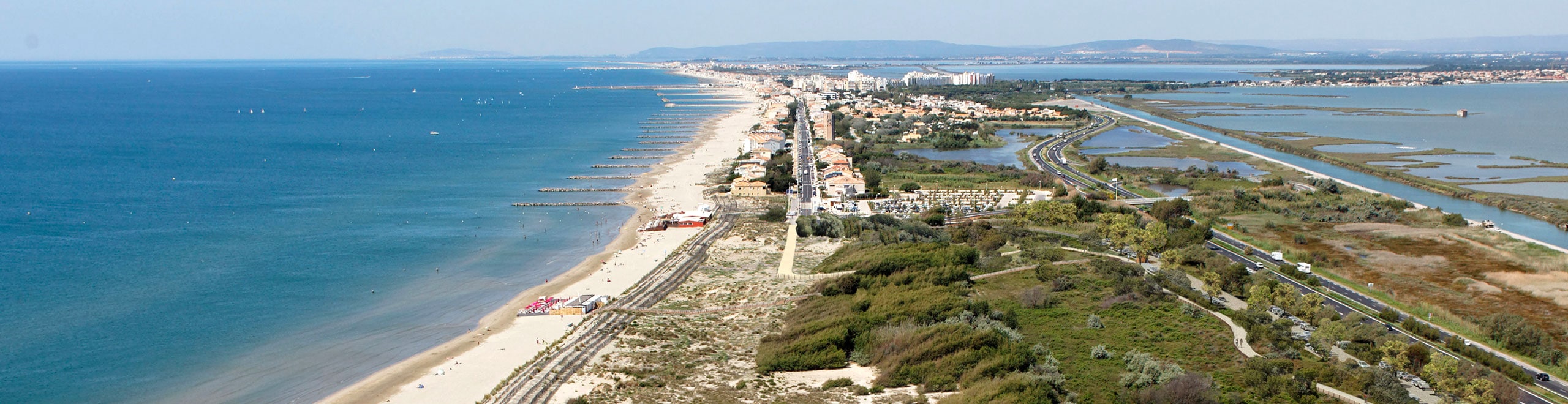
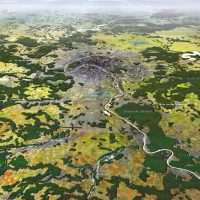
The Ode to the Sea project is a physical application of the SCOT (territorial coherence programme) carried out with Bernard REICHEN over an area of about 1,000 Ha located to the south of Montpellier. It is an “Ecocity” project based on the deconstruction/reconstruction of an out-of-town shopping area consisting of one of the largest collections of
“s.hoe boxes” alongside a 4-lane road punctuated by large roundabouts.
This project is located in an area that is seriously vulnerable to flooding, and is based on an essentially water-based “nature project”. There is a very wide blue line drawn to show the new buildable area.

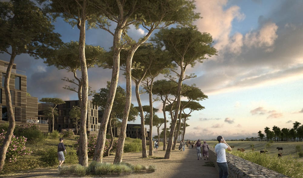
This water-based project which is based on very advanced technical studies shows how to build the city with a strong constraint that is expressed in terms of the project, not regulation. Living with the threat demonstrates that it is possible not to set the city and nature against each other but rather the constraints of one create the renewal conditions for the other.
This project leads to new urban forms built on a totally original ‘edge plan’. These new urban forms, of a city broken down into multiple dense and different hubs, allow another way of living with all the advantages of the city (being close to services and shops) and the countryside (recreation, feel on holiday at home, etc
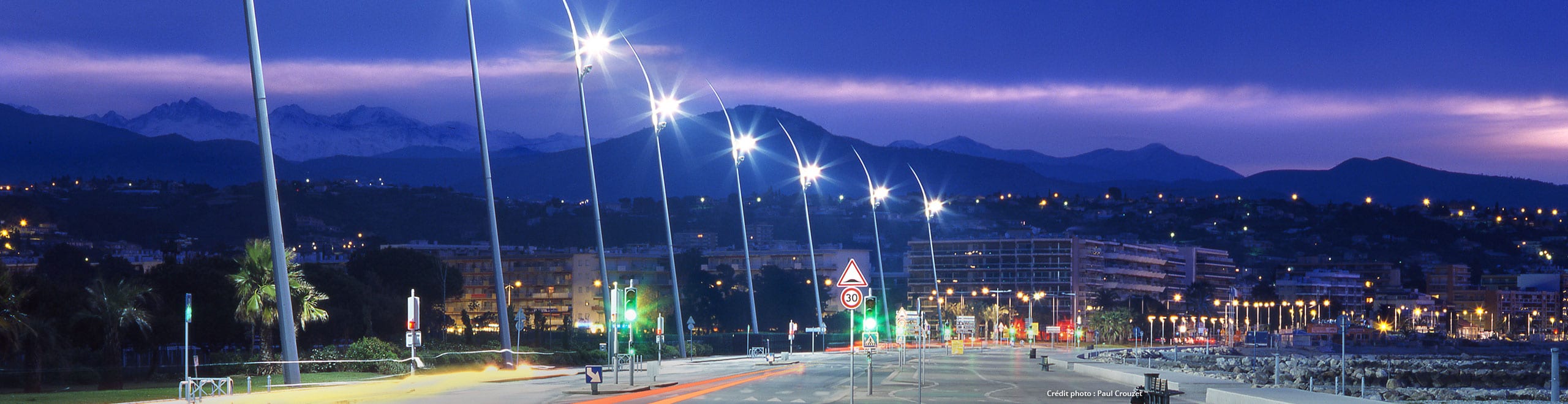
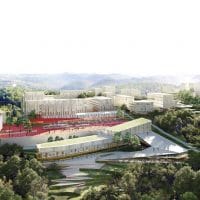
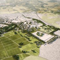
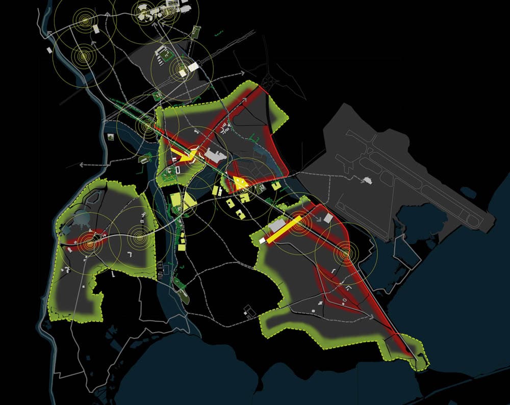
Sophia Antipolis is a top research, business and education centre set in a remarkable wooded and hilly Mediterranean environment. It is hard to find…
This feeling is linked to its unsignposted access system. This technology park is highly congested and given over to cars which ends to isolate it and becomes an obstacle to social life. The specific nature of such an exceptional site is lost and the technology park’s future seems weakened.
Ensure the future of the scientific city
Only a smooth and efficient public transport network will allow Sophia Antipolis to make its mark. The Reichen/Peter team therefore imagined bus rapid transit routes to create new accessibility for the city and to allow the centre to develop into four additional networked living hubs: Trois Moulins, le Fugueiret, la Cité du Savoir and les Clausonnes.
Looking at it the other way: from protection to appreciation of an exceptional natural setting
Almost all the land around the rapid transport bus loop is protected woodland or forest-fire protection zones, which tends to stagnate it.
The urban project was set up around public transport, and its ambition requires that the city be looked at the other way round: these natural spaces will now lie at the heart of the four living hubs, and will bring real change to them.

Create four living hubs around the rapid transport bus loop
A third Departmental park should be created to back up the Natural Parks of la Valmasque and la Brague, so Sophia Antipolis will be able to wear a great green crown more than 1500 hectares around.
By improving the route network, the Fugueireit Departmental Park will become an active connector between the four surrounding living hubs.
The development of sports and relaxation activities in this large natural core will establish the attractiveness of an internationally renowned campus.
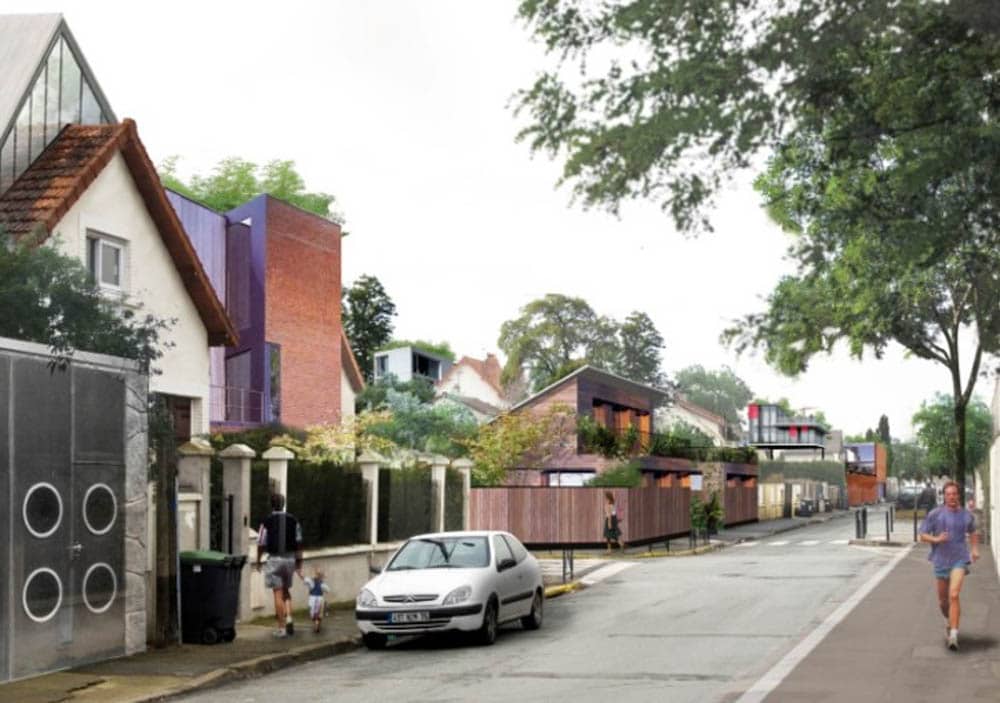
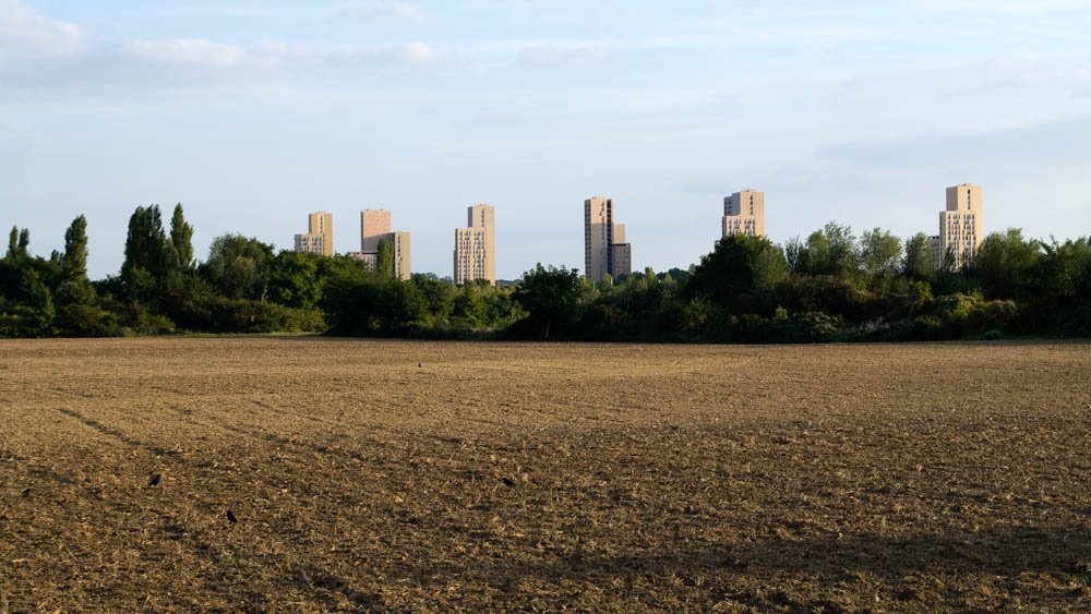
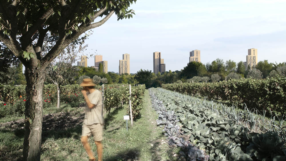
“What would be amazing is to improve the ordinary.”
The climate issue
If we do nothing, the Parisian temperature will reach that of Cordoba in 2100.
We worked with the research team at Météo France on the theory of an overall regeneration of forests, diversification of agriculture and an increase in wetlands in the Paris region. Our calculations show that it is possible to act on a two-degree range.
This action is easy and inexpensive, and it helps redefine the Parisian landscape. It combines an economic objective with better living conditions and recreation facilities which are indispensable for creating a sustainable city.